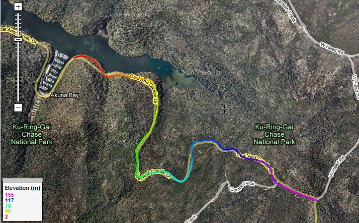
Akuna Bay East
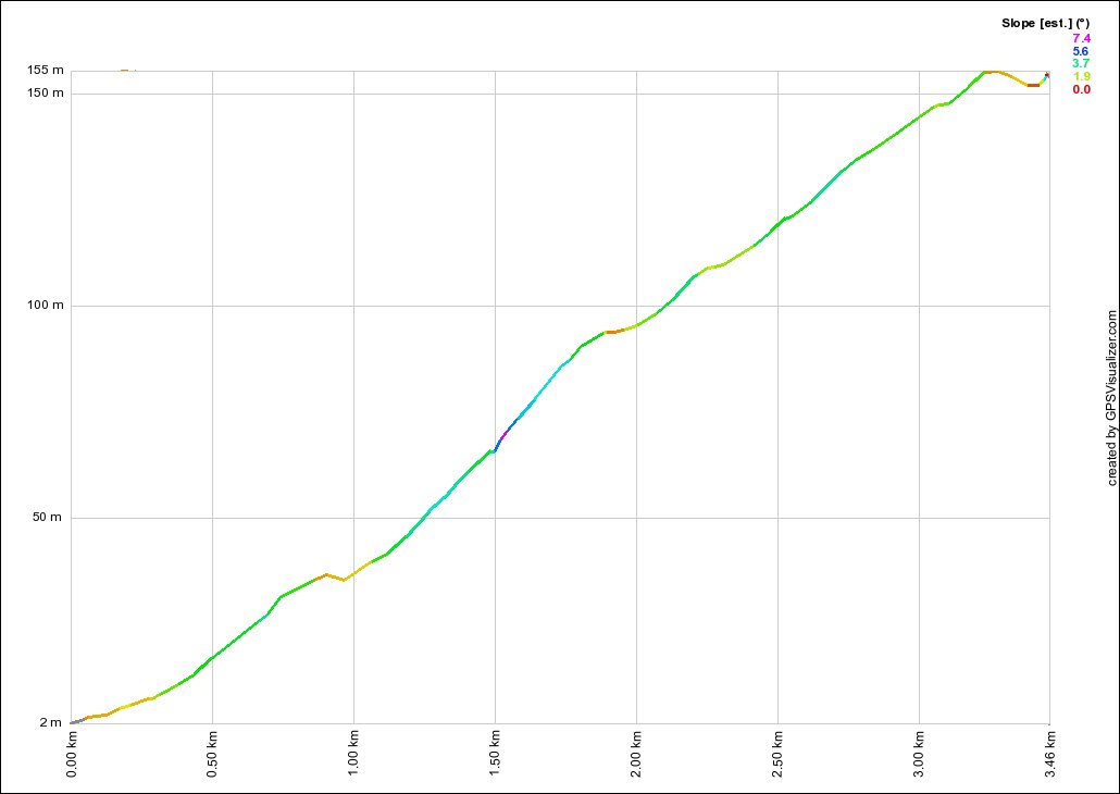
- Distance:
- 3.46km
- Elevation:
- 153m
- Average Gradient:
- 4.4%
- Start Point:
- Just past Akuna Bay Marina
- End Point:
- West head Rd
- Regroup Point:
- West Head Rd
- Climb Description:
- This is considered the easier side of Akuna Bay, even so, 4.4% for nearly 3.5km isn't exactly a walk in the park.
It starts of by slowly increasing the slope, before a slight flattening out and then ramping back up again.
Just before the half way mark, it does get a bit steeper, but once past that it settles down to a steady gradient all the way to the top. There is a bit of a dip before the end, so expect a climber with a sprint to try their luck at the KOM Points.